Red Front Trail
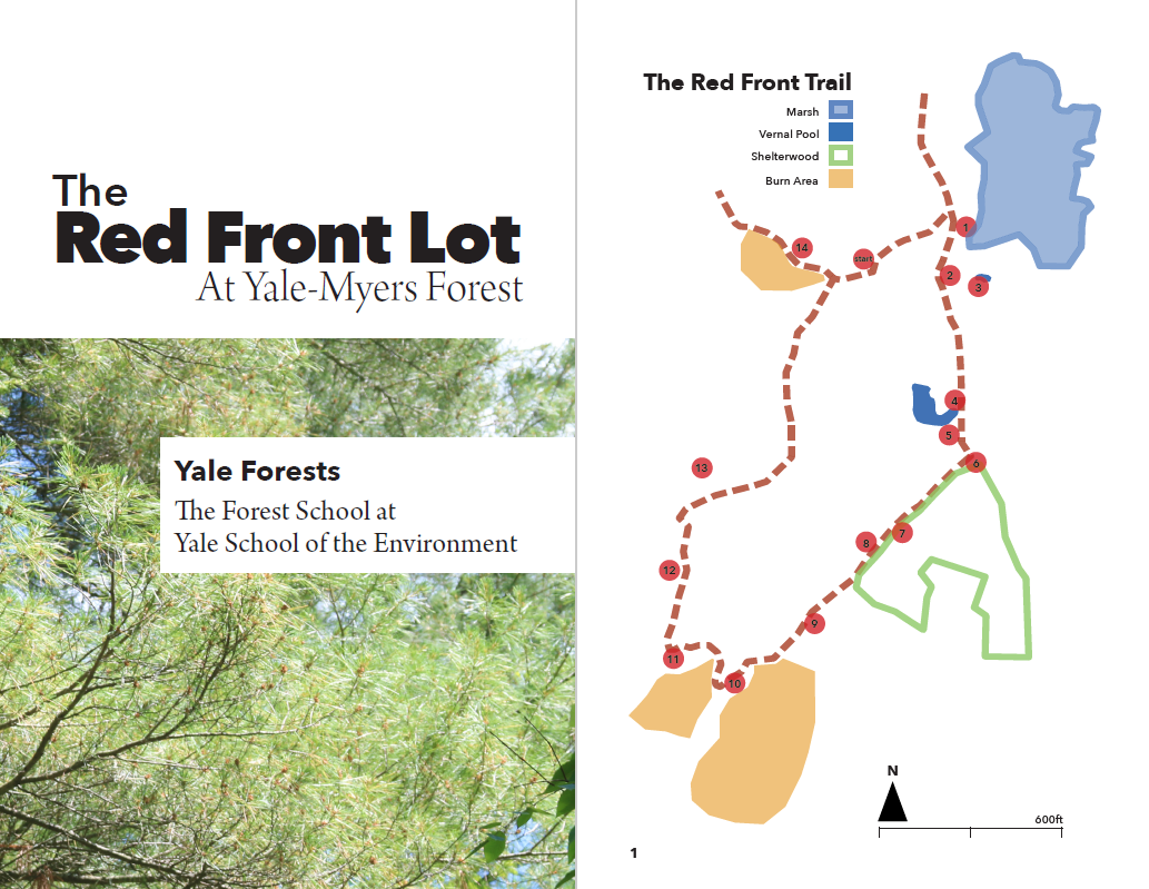
“Welcome to the Red Front Lot, a 180-acre wildlife habitat management and research area within Yale-Myers Forest. The 1.5-kilometer-long trail through this lot will introduce you to a variety of wildlife habitats typical in southern New England forests, and to techniques we are using to improve and manage them.”
We welcome you to engage with the Red Front Trail online through our ESRI StoryMap and flip-through booklet below. See you on the trail!
Red Front Trail StoryMap
For a virtual walk through the Red Front Trail, visit our StoryMap here.
Red Front Trail Booklet
If you’d like to visit the trail with a more traditional guide, check out our trail booklet here.
*****
The original Red Front Trail was designed by Mark Ashton, based on a Coverts management plan for Red Front written by David Kitteredge. There have been countless contributions to trail construction, writing, research, and design over the years from numerous students, staff, and faculty, including Phil Caspar, Frank Cervo, Marlyse Duguid, Shane Duigan, Francis Eaton, Dave Ellum, David Hobson, Tal Ilany, Alison Macalady, Phil Marshall, John McKenna, Vincent Medjibe, Jason Nerenberg, Chris Reily, Steve Roberge, Samantha Rothman, Dave Skelly, Lisa Smith, Becky Tavanni, Ben Urquat, and Steve Prinn.
The StoryMap version of the trail and the accompanying updated booklet were created by Damaris Chenoweth, with support from Rosa Goldman, Laura Green, Jess Wikle, and Karam Sheban. The initiative to digitize the trail was supported by a grant from the Yale Poorvu Center, the Rosenkranz Award for Pedagogical Advancement, to Marlyse Duguid and Mark Ashton.